
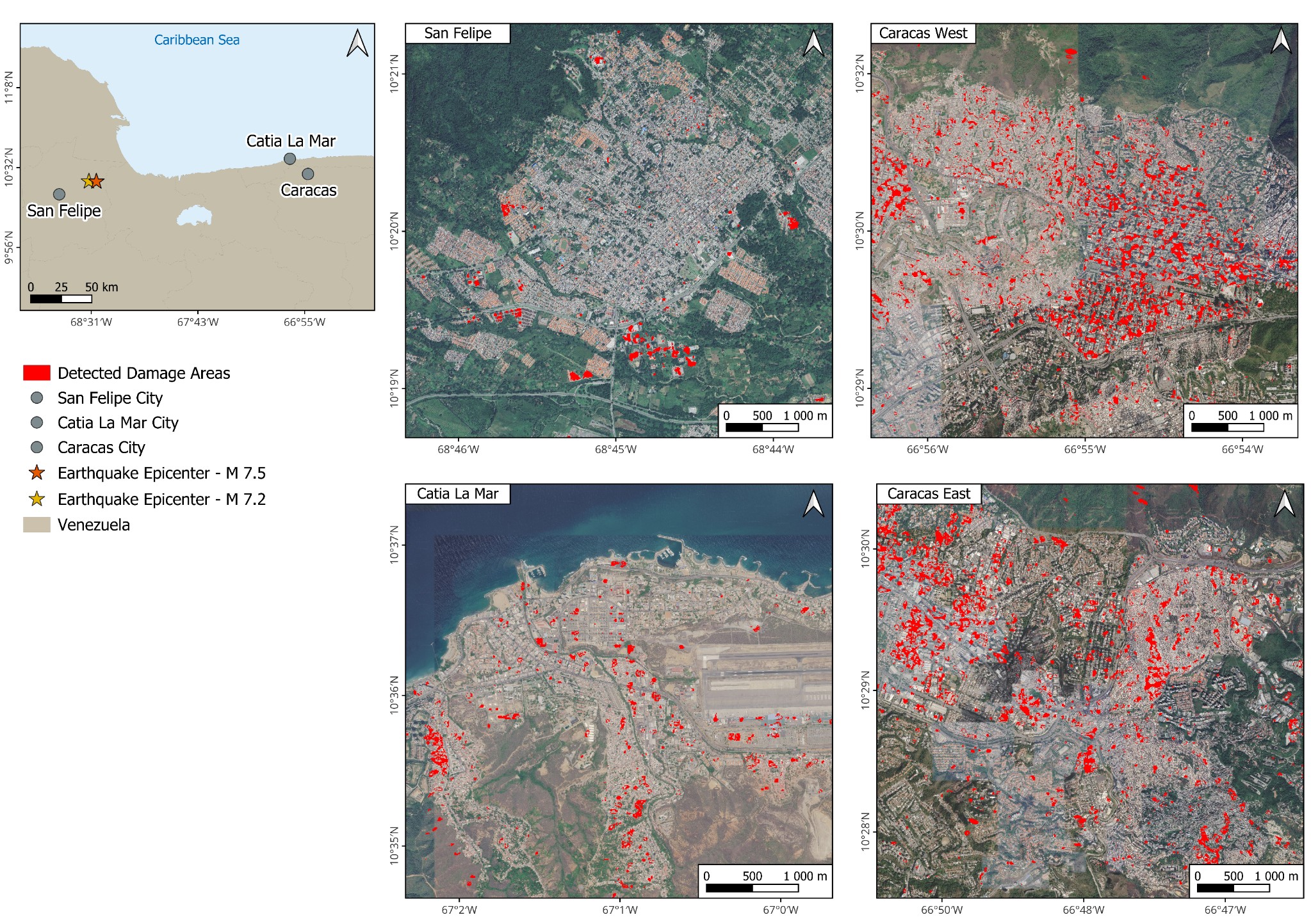
Following the recent earthquake sequence in northern Venezuela, our team rapidly applied its Sentinel-1 SAR change detection methodology to generate a preliminary map of potentially affected urban areas.
The methodology, originally developed and tested following the 2023 earthquakes in Turkey, uses radar observations acquired by Sentinel-1 before and after an earthquake to identify significant changes in satellite backscatter over built-up areas. These changes may indicate areas that may have suffered structural damage or severe surface disturbances.
Using this approach, an initial damage map was produced for the affected regions of northern Venezuela, showing affected zones such as San Felipe, Catia La Mar and Caracas.
This work is currently ongoing, with further analyses being carried out to refine the methodology, evaluate the influence of acquisition geometry and timing, and compare the satellite-derived results with additional information sources as they become available.
The rapid application of a methodology originally developed for Türkiye to a new earthquake event in Venezuela demonstrates the flexibility and operational potential of satellite-based disaster monitoring. By providing a rapid and comprehensive overview of potential impact areas, these products can support more informed decision-making and contribute to a more efficient allocation of emergency resources.